Lingyin to North Peak Hike
A temple-side forest climb to one of the best panoramic viewpoints over West Lake. Moderate effort, big reward.
Lingyin Temple area 灵隐寺 → North Peak 北高峰
Quick Facts
| Distance | ~4 km (one way to summit) |
| Duration | 1.5–2.5 hours |
| Difficulty | Moderate |
| Elevation gain | TBD |
| Start | Lingyin Temple area 灵隐寺 |
| Finish | North Peak 北高峰 |
| Area | Lingyin / North Peak |
| Best season | March–May, October–November |
| Transport | Metro + bus / taxi |
| Crowd level | Medium on weekends, busy on holidays |
| Toilets | Near Lingyin Temple and at North Peak summit |
| Food/water | Near Lingyin Temple; limited options on the trail |
Route Summary
This is the classic Hangzhou hill climb — a forest ascent from Lingyin Temple to the viewing platform at North Peak. The route combines temple grounds, shaded forest trail, and a summit panorama that takes in West Lake, the city, and the hills beyond. It requires more effort than the lakeside walks, but the view from the top is one of the best in Hangzhou.
The trail is well-established and the ascent is a mix of stone steps and packed forest path. It is suitable for anyone with basic fitness, though the uphill sections will raise your heart rate — plan on 1.5 to 2.5 hours depending on pace and breaks. Route details on this page are based on local notes and will be refined as field checks are completed.
How to Get There
By metro + bus
BestTake metro to a station serving the Lingyin / West Lake area, then transfer to a local bus heading toward Lingyin Temple. The exact combination will be confirmed during field checks. Use 灵隐寺 in map apps to confirm the closest stop.
By taxi
A taxi from central Hangzhou to Lingyin Temple typically takes around 20–30 minutes depending on traffic. Show the driver 灵隐寺. The fare is usually reasonable. At the finish, a cable car descends from North Peak to the Lingyin area, or you can walk back down.
Cable car option
There is a cable car from the base near Lingyin to the North Peak summit area. This page describes the hiking route up, but the cable car is available as a descent option or for visitors who prefer not to hike.
Save these in your phone before starting: 灵隐寺 (Lingyin Temple, start), 北高峰 (North Peak, summit), 灵隐景区 (Lingyin Scenic Area).
Step-by-Step Route
Route notes are based on local knowledge and will be refined with field checks. Approximate times assume a relaxed pace with short photo stops.
Lingyin Temple area to the trail head
~10–15 minStart in the Lingyin Temple area 灵隐寺. From the temple entrance, follow signs toward the North Peak hiking trail. The trail head is a short walk from the temple complex, past the main temple grounds. The initial path is paved and gently sloped. Use this section to orient yourself — the trail will be confirmed during field checks.
Forest ascent
~40–60 minThe trail transitions from paved path to stone steps and forest trail as it begins climbing. The forest section is mostly shaded with mixed bamboo and broadleaf trees. This is the main ascent — expect steady uphill hiking on a mix of stone stairs and dirt path. Take breaks as needed. The trail is well-used and generally easy to follow, though side paths may branch off. Stay on the main uphill route.
Caution: Stone steps can be uneven and may become slippery after rain. Pace yourself on the uphill sections — the climb is sustained but manageable.
Ridge approach to the summit
~20–30 minAs you approach the ridge, the forest canopy opens up and you begin to see glimpses of West Lake through the trees. The final section levels out slightly before the last push to the summit platform. Signs and trail markings will be confirmed during field checks.
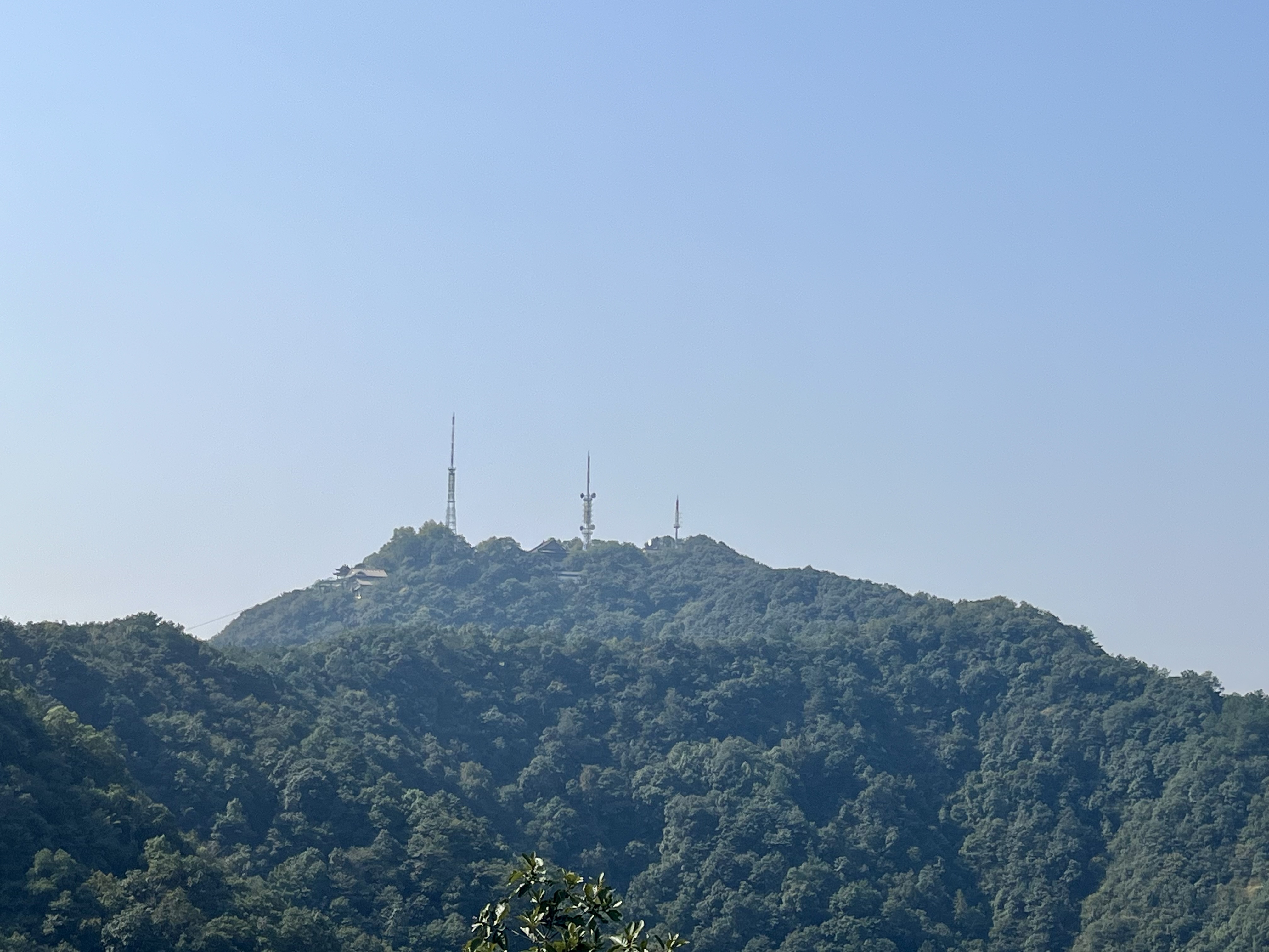
North Peak summit and viewpoints
~20–30 minAt the summit, a viewing platform offers wide panoramic views of West Lake, the city, and surrounding hills. This is the highest publicly accessible viewpoint on the north side of the lake. The summit area includes basic facilities — toilets, a small shop, and the cable car station for the descent. On clear days you can see across the lake to the southern hills.
Photo suggestion: Panoramic view of West Lake from the North Peak viewing platform.
Photo Guide
Key photo points along the route. Real photos will be added after field checks.


Practical Notes
Food and water
Available near Lingyin Temple at the start. Limited options on the trail itself. The summit has at least a small shop. Bring at least 1 litre of water per person for the uphill section.
Toilets
Public toilets are usually available near Lingyin Temple and at the North Peak summit area. There are no toilets along the forest ascent.
Phone signal
Mobile signal is generally reliable for most of the route. The forest section may have brief weak spots. Download offline maps as a backup.
Trail surface
Paved paths near the temple, transitioning to stone steps and packed dirt forest trail. The ascent has many stairs. Some stone sections may be uneven.
Payment / cash
Lingyin Temple area usually requires an entrance ticket. Some small vendors may prefer local mobile payment methods. Carry a little cash as backup.
Rainy day notes
Stone steps become slippery after rain. The forest canopy provides some shelter but waterproof shoes are recommended. Avoid in heavy rain.
Crowds
Lingyin Temple is a major tourist attraction and can be very busy on weekends and holidays. The trail itself is less crowded than the temple area. Start early on weekends.
Safety Notes
- Stone steps can be slippery after rain. Wear shoes with good grip and take your time on the descent.
- Summer heat and humidity in Hangzhou can be intense. Start early, bring plenty of water, and take breaks as needed on the climb.
- The ascent is sustained and may be challenging in hot weather. Pace yourself — there is no rush.
- Save 灵隐寺, 北高峰, and 灵隐景区 in your phone before setting out for taxi drivers and map navigation.
- Avoid the route during heavy rain or typhoon weather. Check the forecast before heading out.
Best Time to Go
Spring
RecommendedMild temperatures and active greenery. The forest is lush and temple gardens are at their best. Popular season.
Summer
The forest offers shade but humidity is high and the climb is strenuous in heat. Start very early and bring extra water.
Autumn
RecommendedClear skies and comfortable temperatures. The best season for visibility from the summit — West Lake panoramas are at their clearest.
Winter
Cooler and quieter. The forest is less lush but the trail is still walkable. Clear winter days offer good views.
Frequently Asked Questions
Short answers to common planning questions about transport, Chinese place names, timing, and safety for this route.
-
Is Lingyin to North Peak suitable for beginners?
Moderate difficulty. The route involves a sustained uphill climb on stone steps and forest trail over about 4 km (one way to the summit). It is suitable for people with basic fitness who are comfortable with continuous climbing, but it is more strenuous than easier Hangzhou walks like Longjing to Nine Creeks. -
Can I reach Lingyin to North Peak without a car?
Yes. Lingyin Temple 灵隐寺 is reachable by bus or taxi from central Hangzhou. A taxi from the city center takes about 20–30 minutes — show the driver 灵隐寺. From the North Peak summit at the finish, you can take the cable car back down to the Lingyin area, where bus connections are available. Exact bus routes are still being field-checked. -
How long does the Lingyin to North Peak hike take?
Plan for 1.5 to 2.5 hours for the one-way ascent of about 4 km. The return trip — either walking back down or taking the cable car — adds another 20–40 minutes. The total outing from base to base is typically 2 to 3 hours at a moderate pace. -
What Chinese place names should I save for Lingyin to North Peak?
Save at least three names in your phone before starting: 灵隐寺 (Lingyin Temple, the start), 北高峰 (North Peak, the summit), and 灵隐景区 (Lingyin Scenic Area, the broader area). These help with taxi navigation, bus stops, and local map apps. -
Is the Lingyin to North Peak trail safe after rain?
The stone steps on the ascent and descent can become slippery after rain — wear shoes with good grip and take extra care on the downhill sections. The forest canopy provides partial shelter. Avoid the route during heavy rain or typhoon conditions. This route is still an early draft and field checks are planned to verify all conditions. -
Where can I find toilets and water on the Lingyin to North Peak route?
Toilets and food options are usually available near Lingyin Temple 灵隐寺 at the start and at the North Peak 北高峰 summit area. There are no toilets or food vendors along the forest ascent, so bring at least 1 litre of water per person. -
Can I take a cable car to the top of North Peak?
Yes. A cable car operates from near Lingyin Temple to the North Peak summit area. It is a popular option for descending after hiking up, or for visitors who prefer not to hike. The cable car station is clearly signposted near the Lingyin Temple complex. -
Do I need to pay to enter Lingyin Temple?
Lingyin Temple and the surrounding scenic area usually require an entrance ticket. Whether the hiking trail to North Peak requires passing through the ticketed area is still being confirmed — this will be updated during field checks. -
Can I do this hike if I don't speak Chinese?
Yes. The trail itself does not require Chinese language skills. The path is clearly marked and the area is a major temple and hiking area. Note that the route may involve the Lingyin ticketed scenic area — ticket and entrance details are still being field-checked, so confirm the exact entry route before setting out. We recommend saving the Chinese place names from the "Chinese Names to Copy" card on this page before setting out — they are useful for taxi drivers, bus signs, and map apps. AMap (高德地图) has an English interface and works well for navigation. -
Is this hike safe to do alone?
Generally yes. This is a popular trail with regular foot traffic on weekends. Phone signal is generally reliable on most of the route. As with any solo hike, tell someone your route plan, carry a power bank, and download offline maps before you start. The trail is within the city area, so help is not far away. Note that the Lingyin Temple entrance fee arrangement is still being field-checked — confirm the entry route before you go. -
Is there phone signal on the trail?
Signal is generally reliable on the main trail. Some brief weak spots in denser forest sections near the ridge. Downloading offline maps as a backup before you start is recommended, particularly for the ridge section where signal may be weaker. -
What time should I start this hike?
In summer (June–August), start before 7:00 am to avoid the midday heat and humidity. In spring and autumn, 8:00–9:00 am is a comfortable start time. In winter, 9:00–10:00 am works well. The hike takes approximately 1.5–2.5 hours, so an early start also helps you avoid crowds and find better light for photos. Starting by 2:00 pm still allows you to finish well before sunset.
Nearby Routes
Other trails starting from the same area, worth combining or visiting on another day.
Longjing to Nine Creeks
Tea fields, forest paths, and a shaded stream valley. One of the best first-time hikes in Hangzhou.
Baoshi Mountain West Lake View Walk
A short city-side hill walk with classic views over West Lake and Baochu Pagoda. Easy and quick.
Meijiawu to Longjing Tea Fields
A quiet tea village walk through Longjing plantations and hillside paths. Peaceful and scenic.
PlannedField Notes
Route details are maintained through local notes, field checks, photo updates, and transport revisions.